Our trips
Italy Coast2Coast (255 mi)
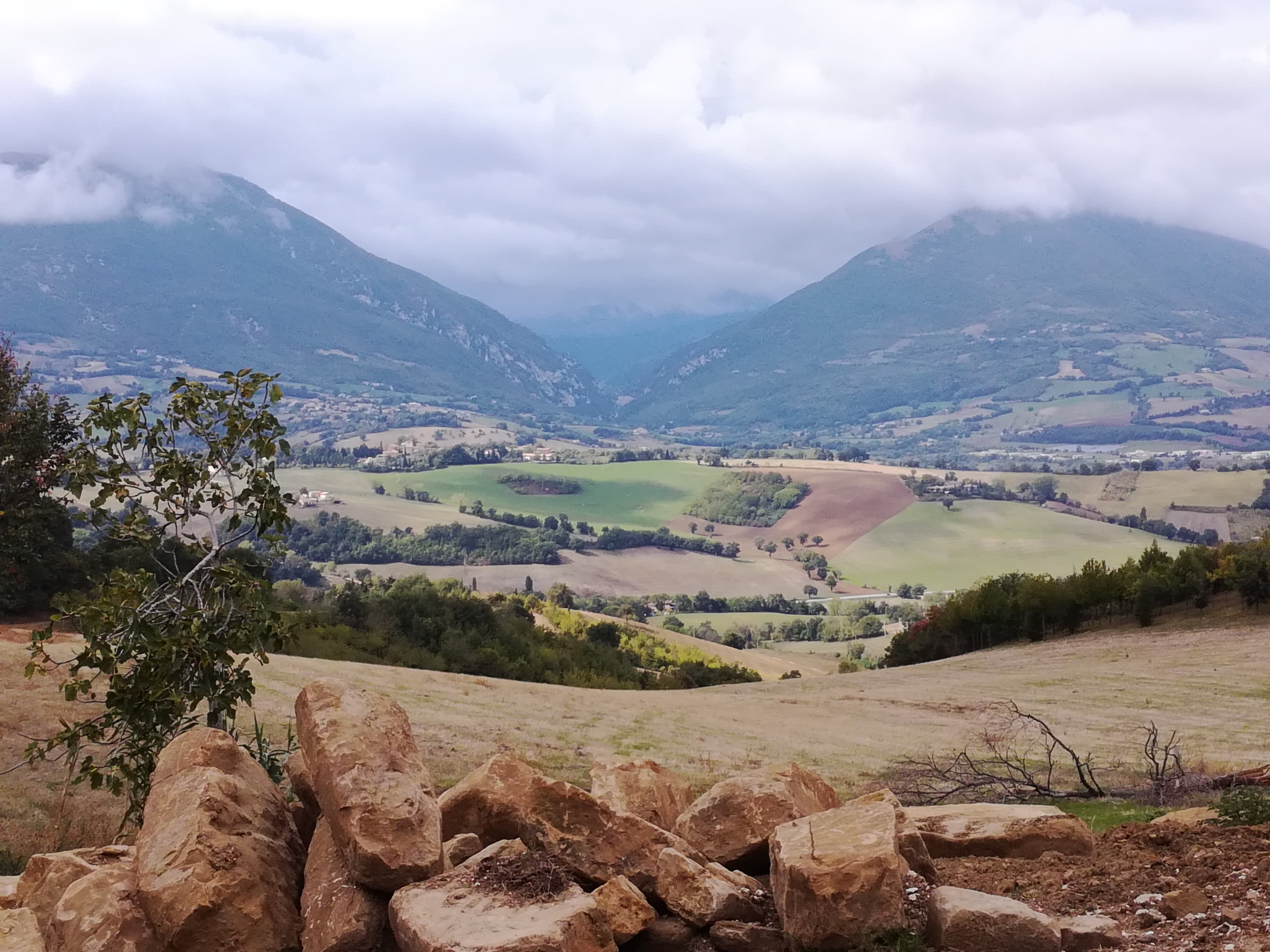
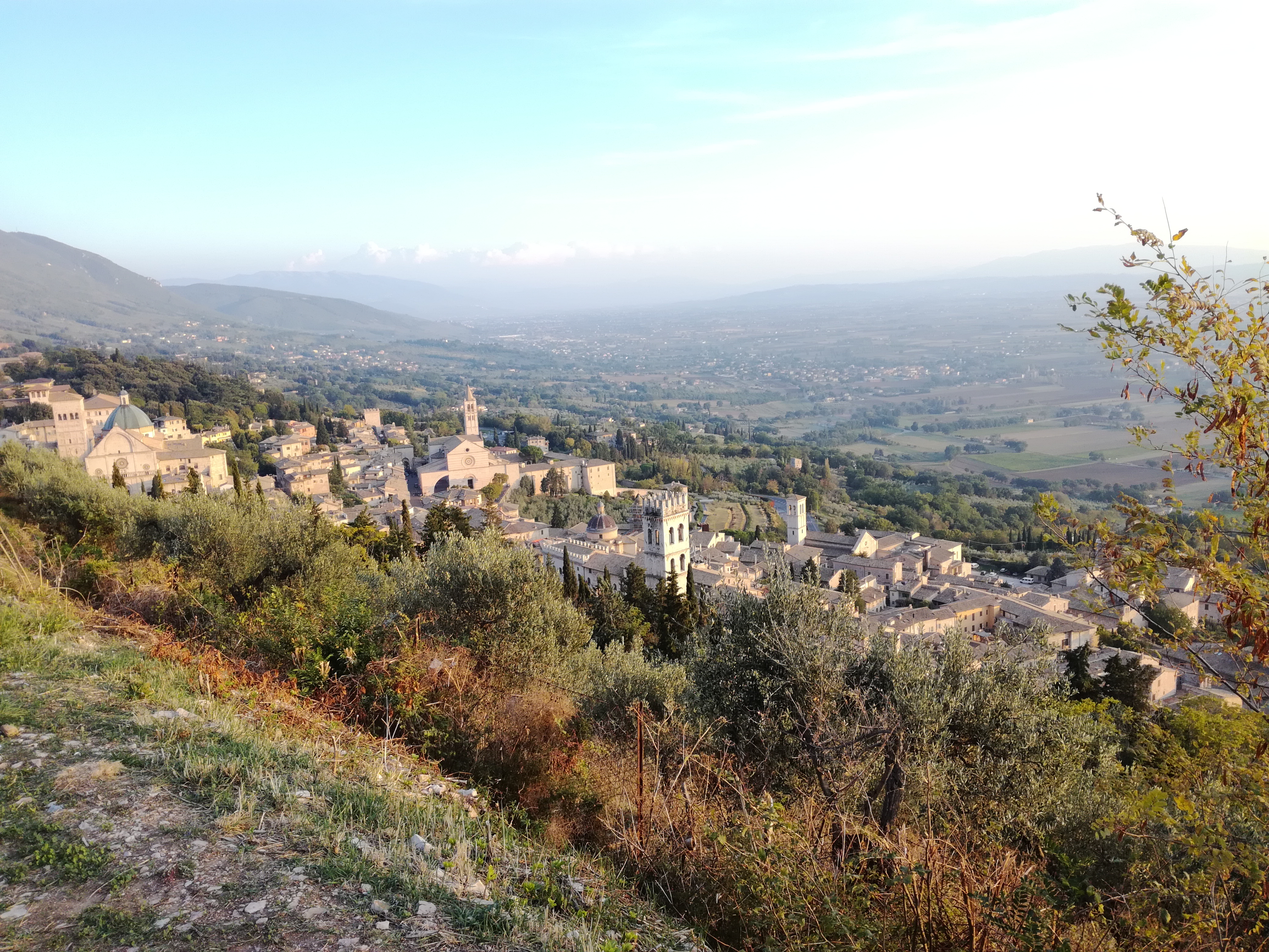
Sea, valley, hills, mountain. This trail, which passes through some of the most beautiful Italian landscapes, links the Adriatic Sea to the Tyrrhenian Sea, the Marches' coast to the Tuscany's one. The route, which consists of 18 stages across four regions, touches several towns rich in art and history, like Assisi, Orvieto, Todi, and many others that contribute in making this path a must for all the long-distance hiking-lovers.
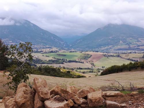 The Umbria-Marche Apennines |
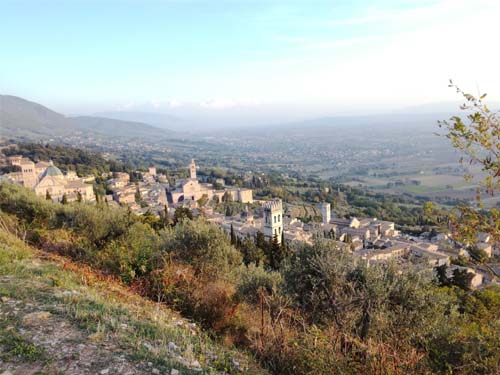 Assisi |
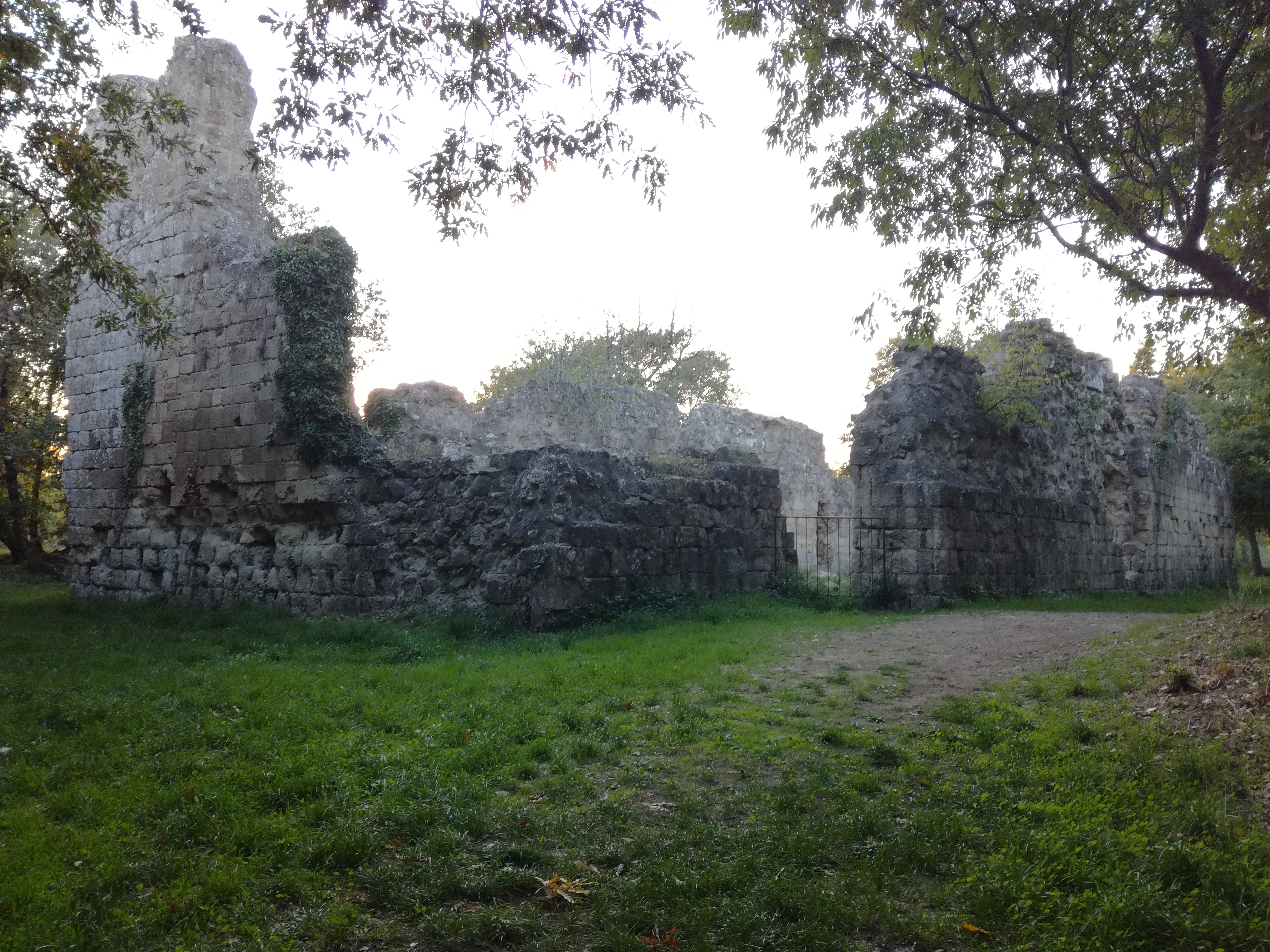
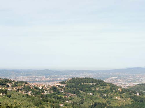
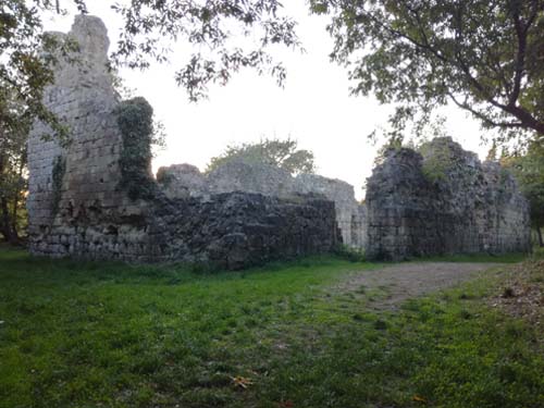 The ruins of Vitozza, in Tuscany |
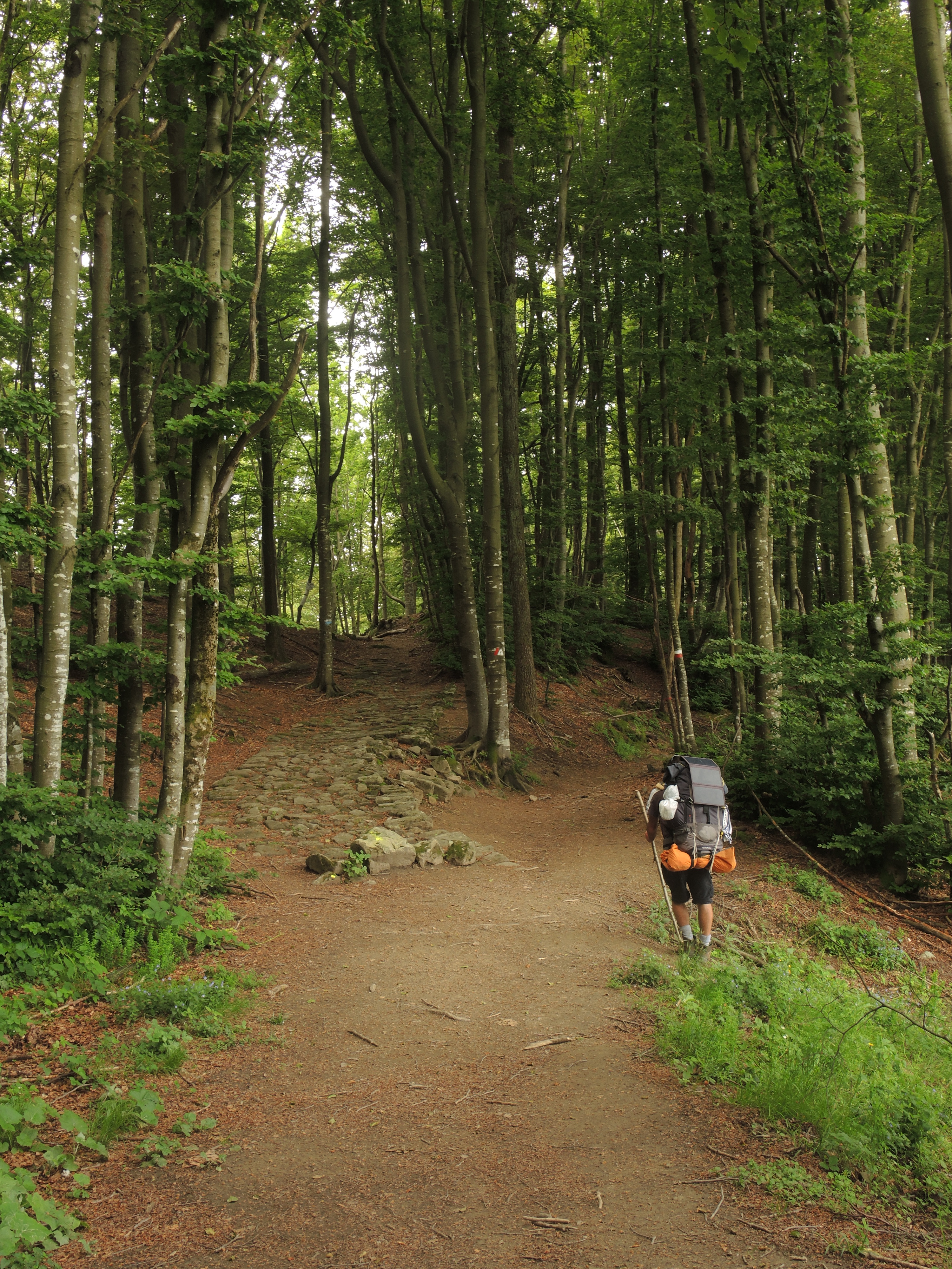
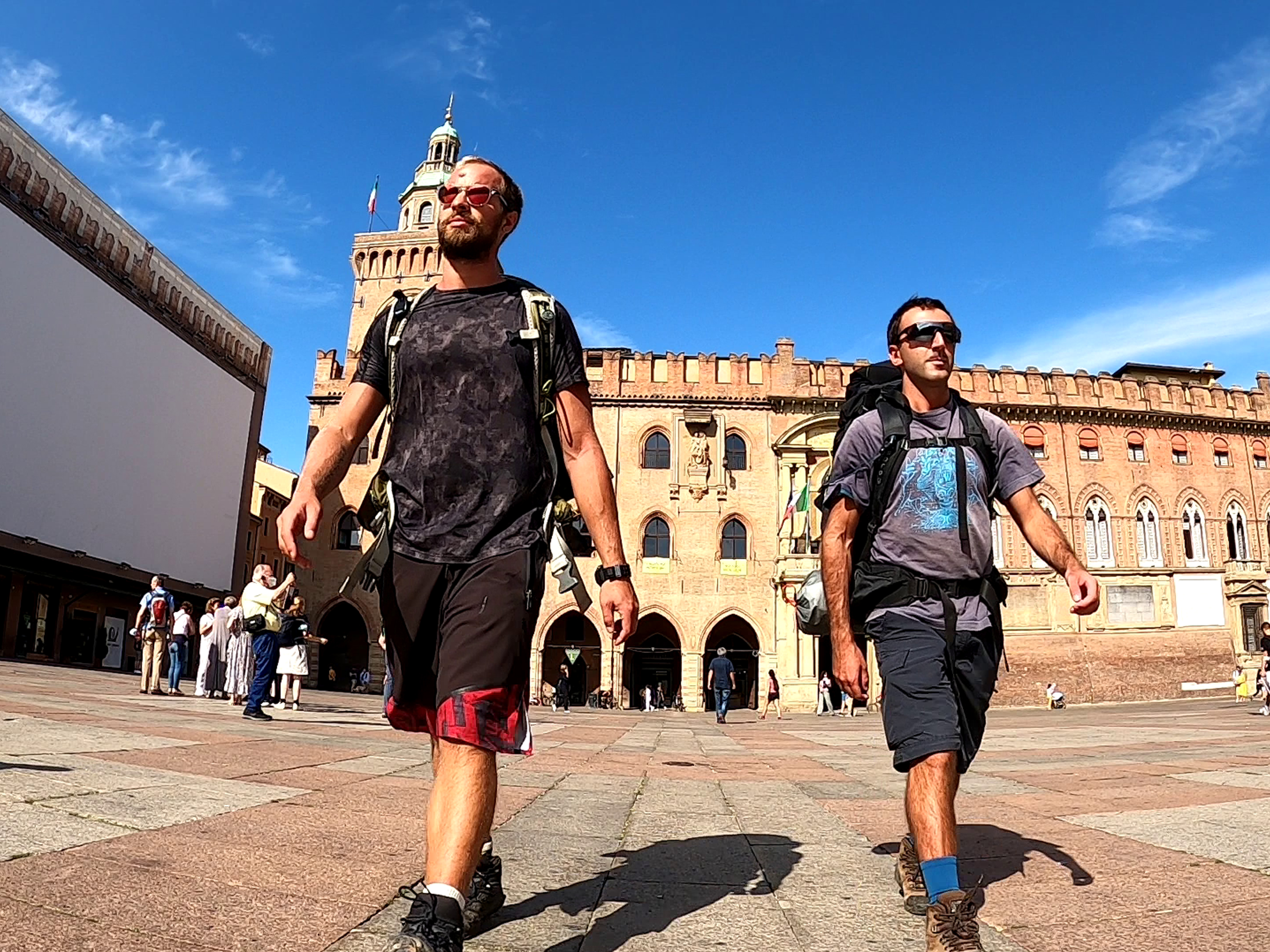
Via degli Dei (81 mi)
Seven days of walking from Piazza Maggiore, in Bologna, to Piazza Della Signoria, in Florence. In between, there is the mysterious charm of the Tuscan-Emilian Apennines, a border where people, stories, and traditions meet and merge into each other. This trail spans over millennia, as testified by the Flaminia Militare, a road that led the Roman legions to the conquest of the Po Valley, and which ruins are still visible beside the track.
Link to the official website
Click here to download the GPX track
![]()
Click here to download the KML track
![]()
Explore the trail on Google Maps!
![]()
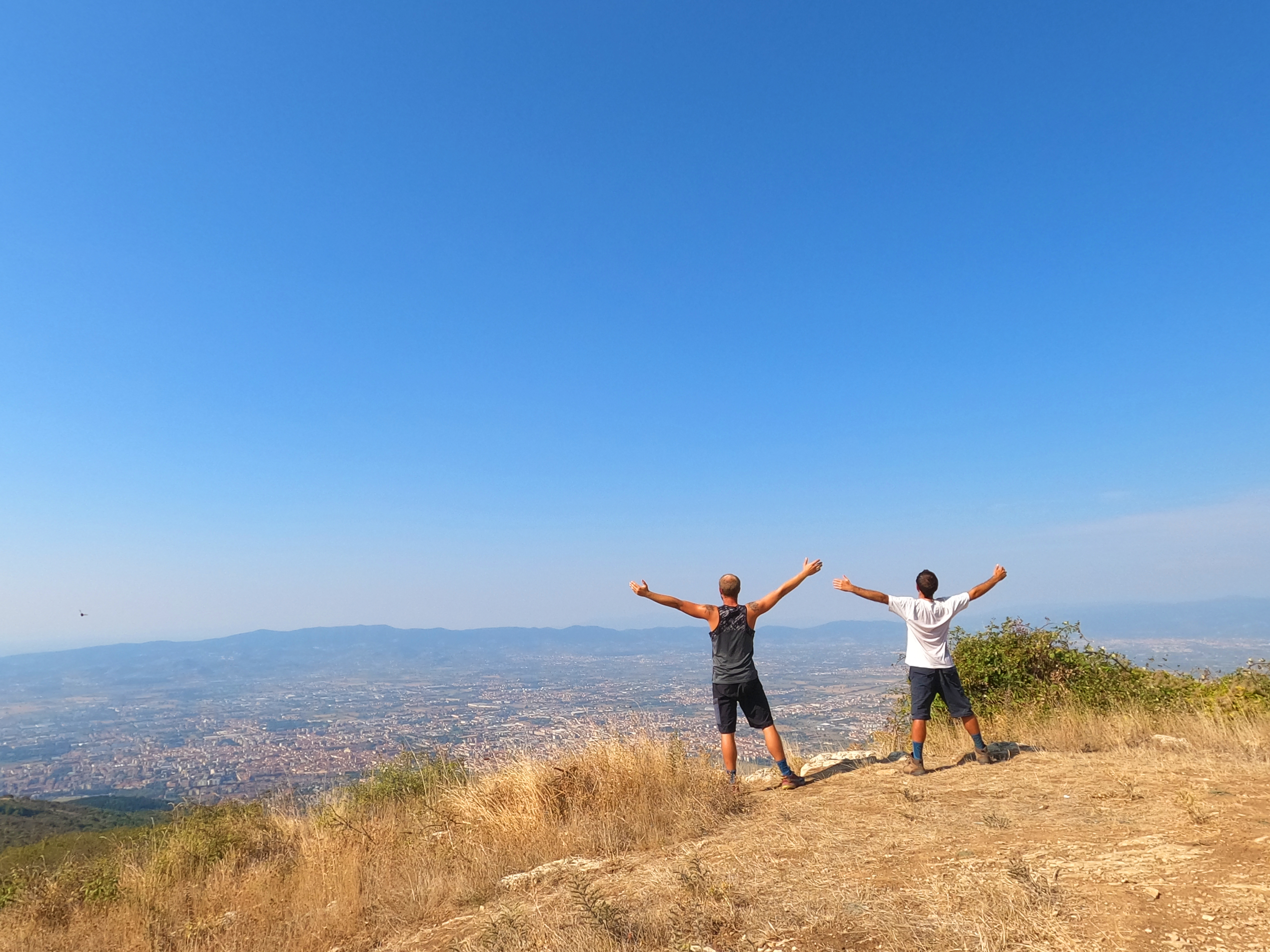
 Panoramic view from the top of Monte Adone |
 The ruins of Flaminia Militare |
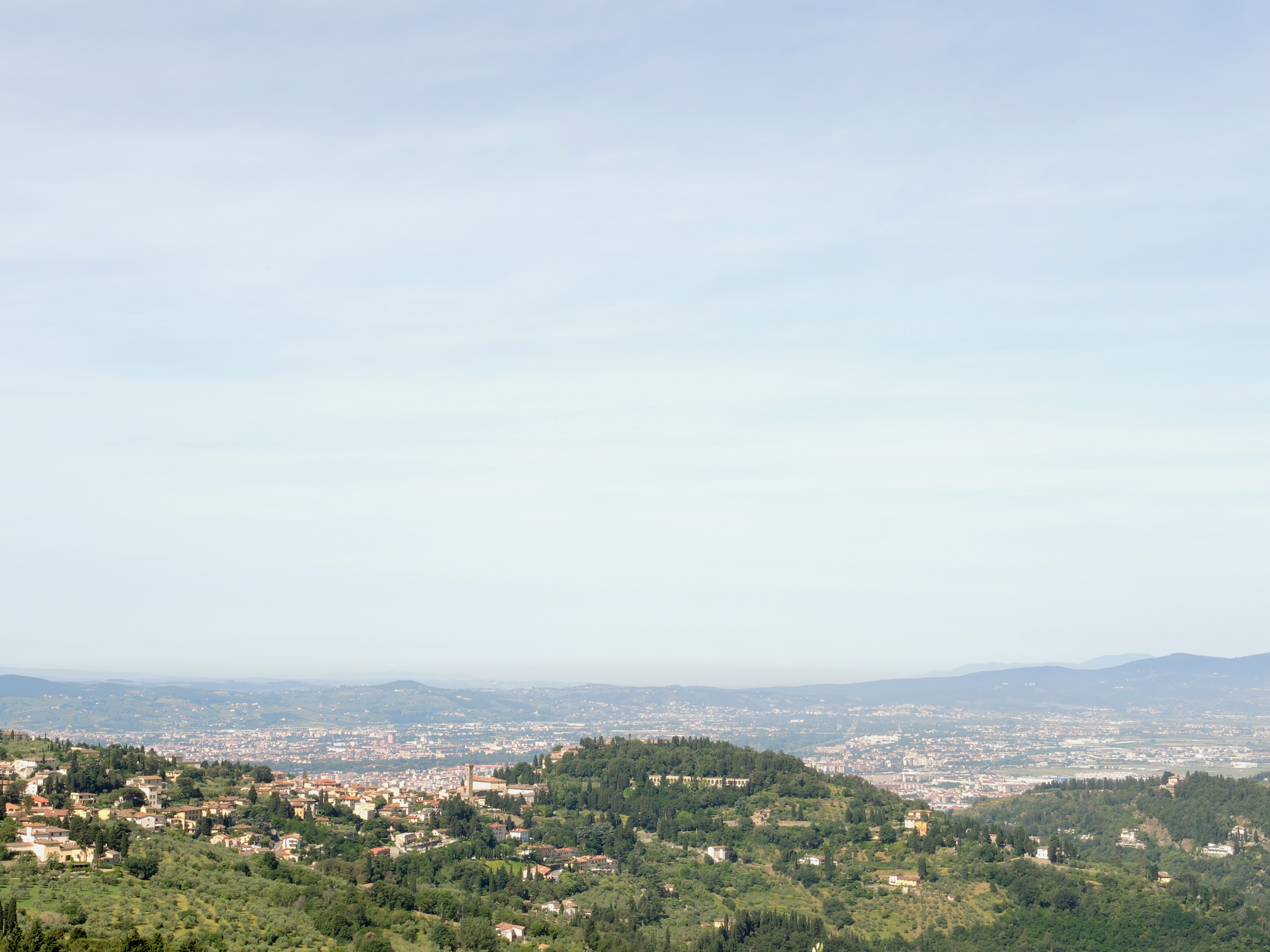
 Fiesole, and in the background Florence |
Via della lana e della seta (81 mi)
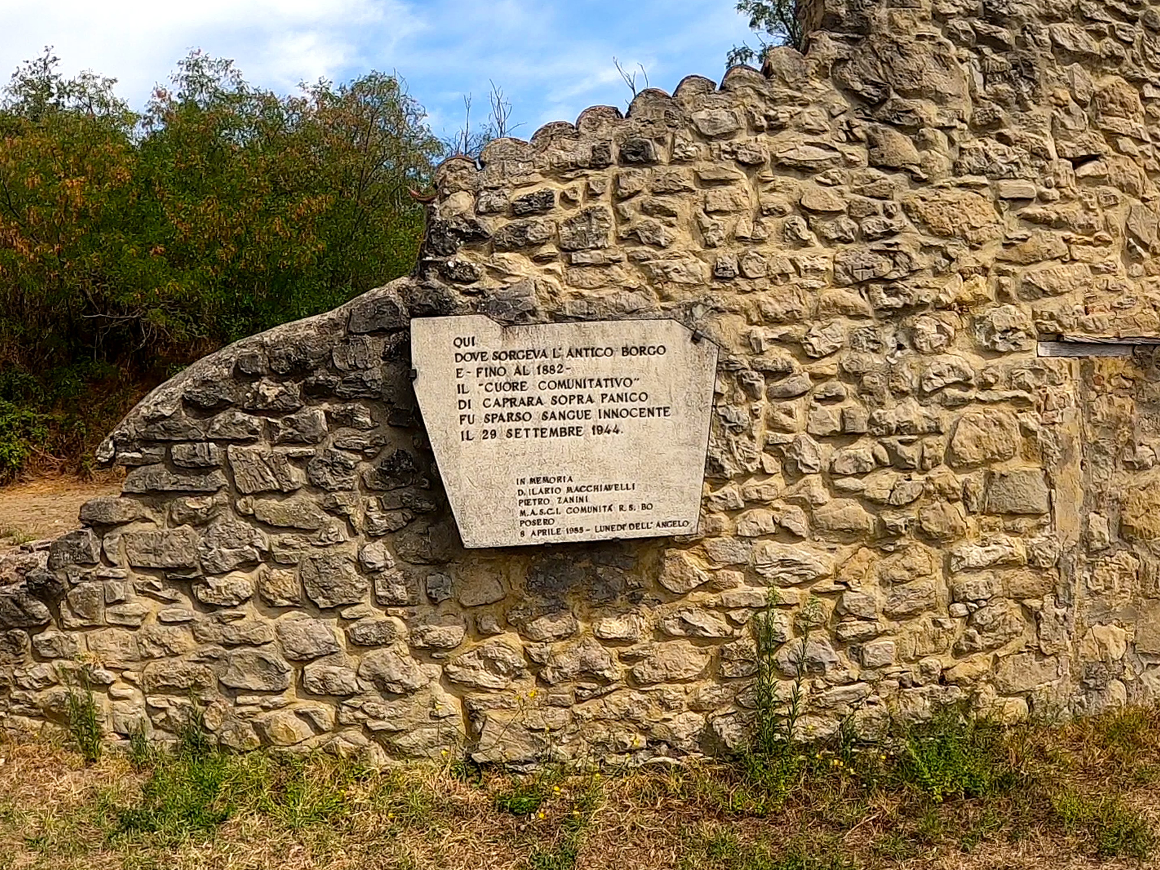
The Via della Lana e della Seta (Wool and Silk Road) links Bologna to Prato, running almost parallel to the Via degli Dei, and owes its name to the two products that have characterised the manufacturing activities of the respective cities since the Middle Ages. Amidst breathtaking views and wonderful paths through the woods, the route also offers important historical evidence, from the Etruscan ruins scattered throughout the territory to the Monte Sole Park, sadly famous for the massacres carried out by the Nazi-Fascists in 1944.
Link to the official website
Click here to download the GPX track
![]()
Click here to download the KML track
![]()
Explore the trail on Google Maps!
![]()
Link to the official website
Click here to download the GPX track
![]()
Click here to download the KML track
![]()
Explore the trail on Google Maps!
![]()
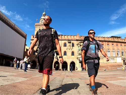 Start from Bologna |
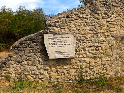 Commemorative plaque at Monte Sole Commemorative plaque at Monte Sole |
 View over Prato |
Shikoku Pilgrimage (708 mi)
This circular route touches 88 Buddhist temples situated on the island of Shikoku, in Japan. It is an extremely impactful journey, both spiritually and emotionally. By walking it, you will venture among temples hidden in the mountains, centuries-old traditions, and the smiles of the inhabitants, discovering a rural Japan that still retains its ancient beauty.
Link to the official website (English and Japanese)
Click here to download the GPX track
![]()
Click here to download the KML track
![]()
Explore the trail on Google Maps!
![]()
Link to the official website (English and Japanese)
Click here to download the GPX track
![]()
Click here to download the KML track
![]()
Explore the trail on Google Maps!
![]()
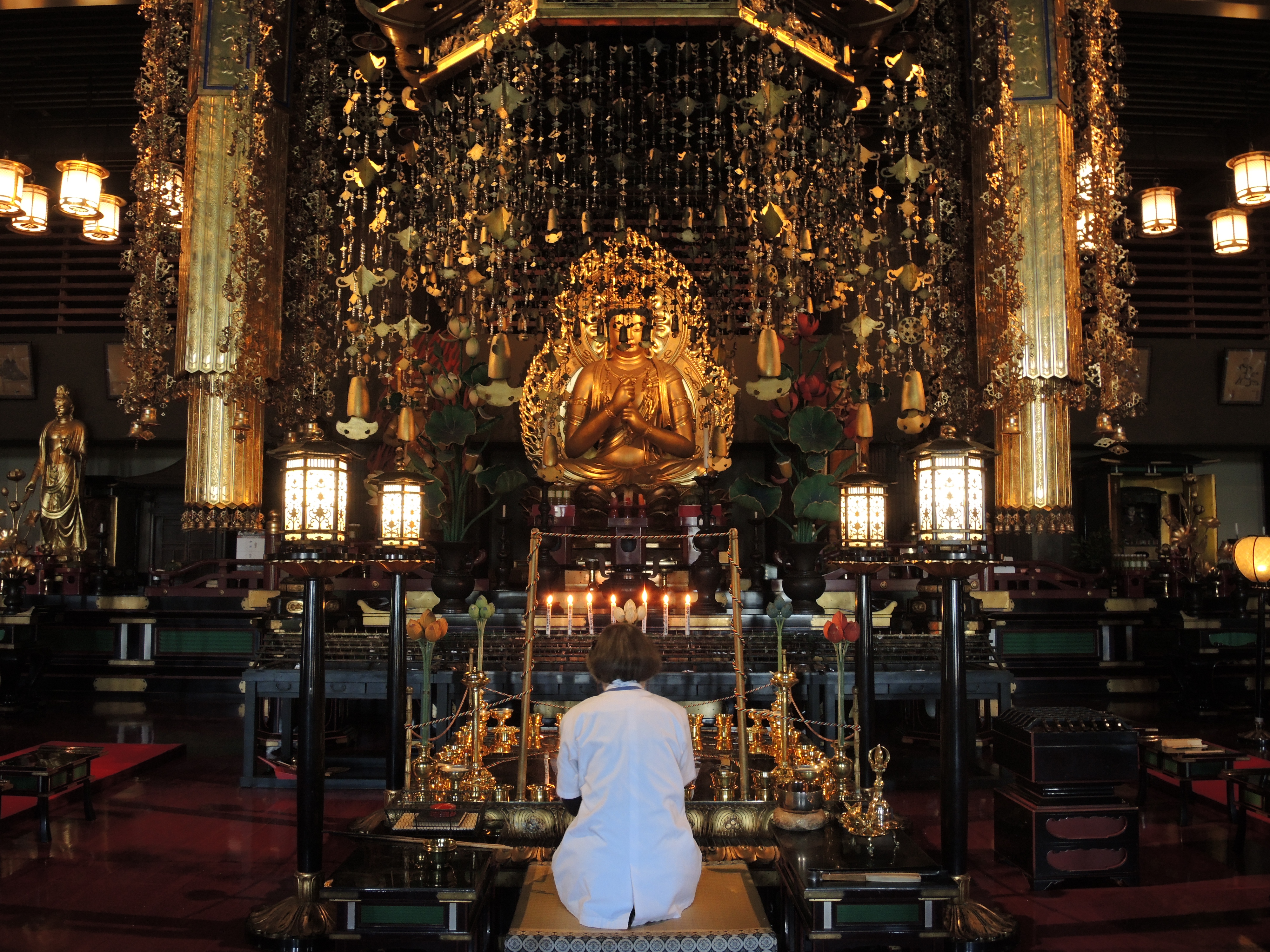
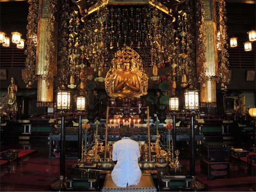 Inside one of the temples |
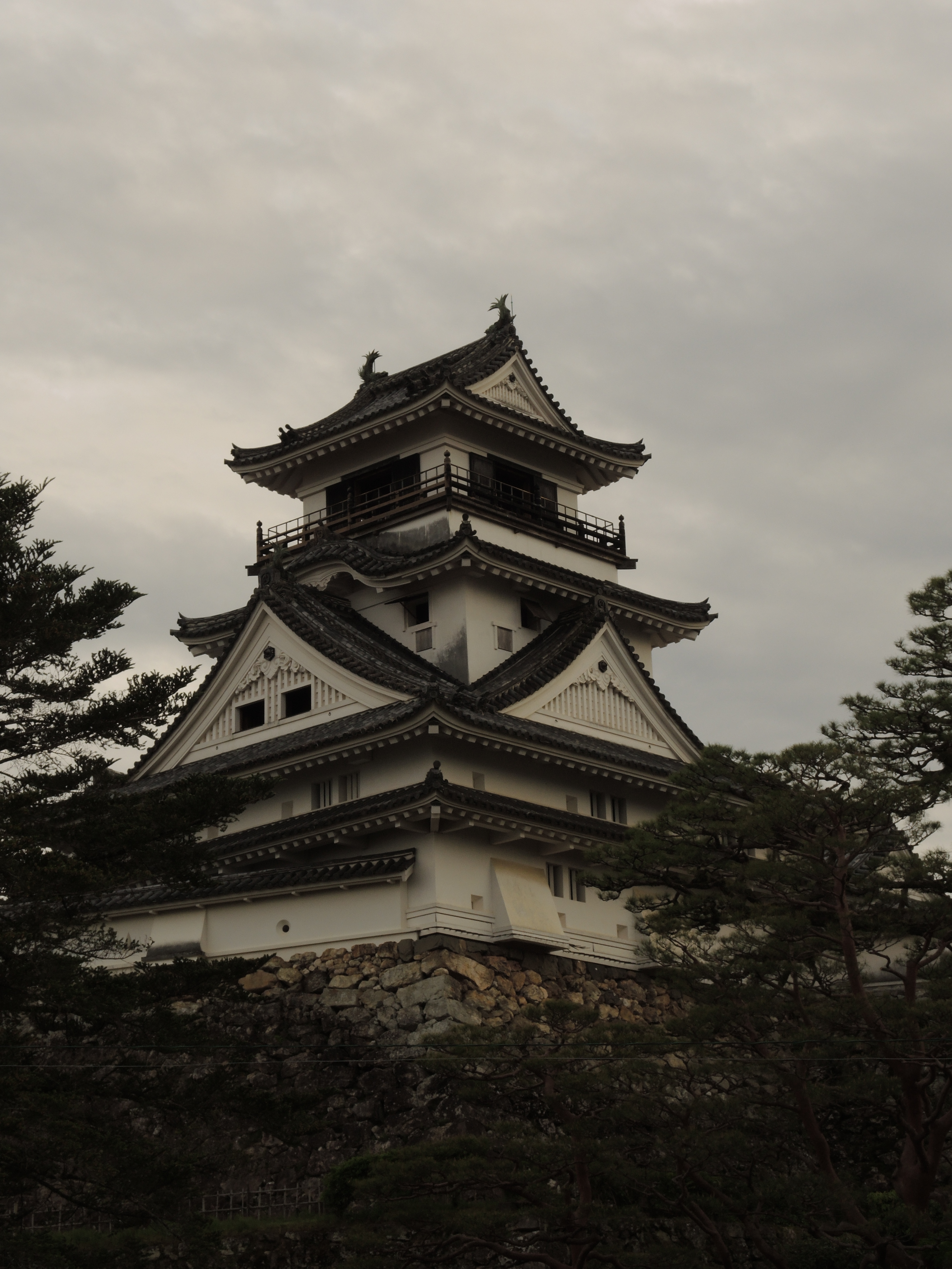
 Kōchi castle |
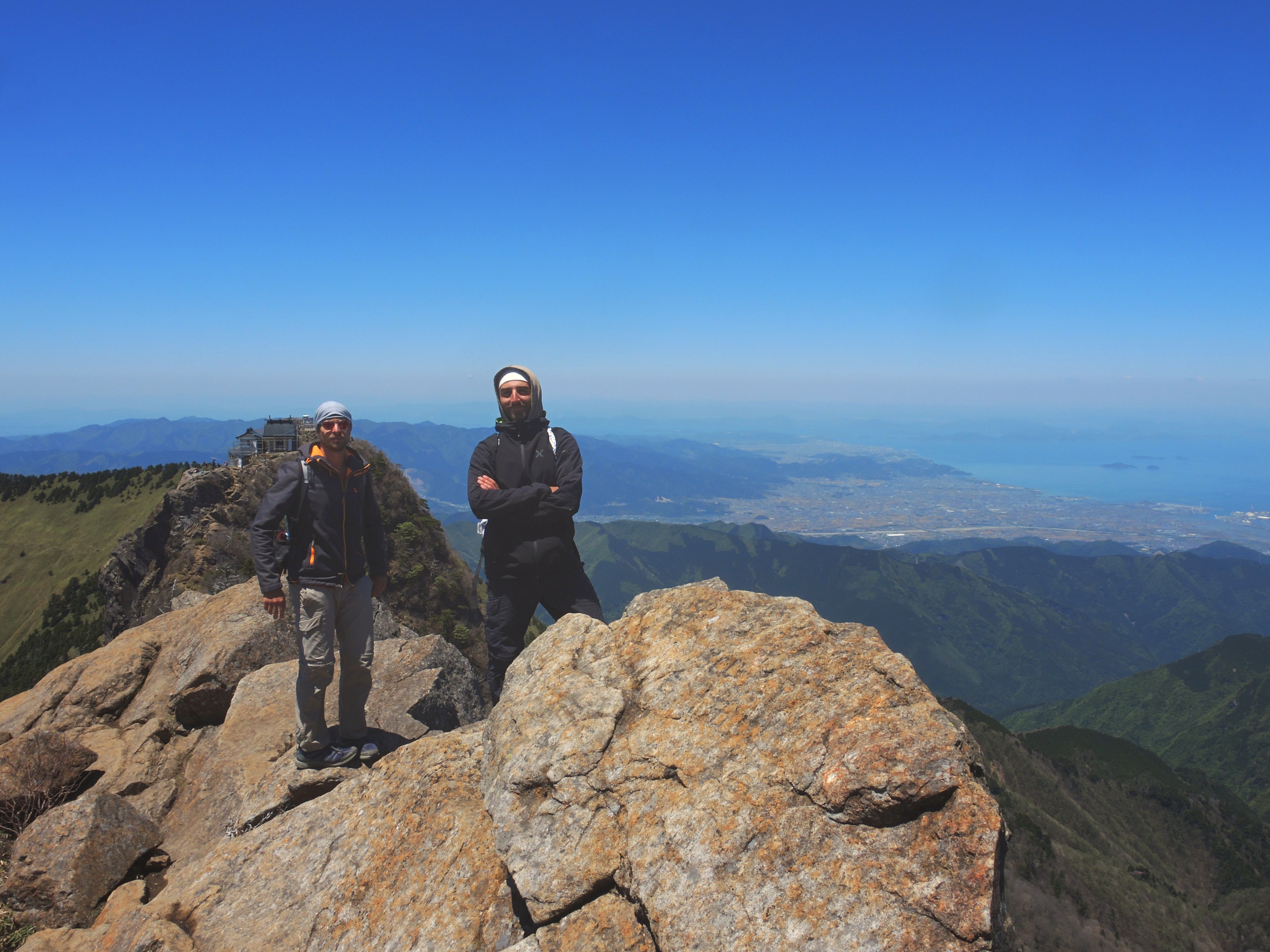
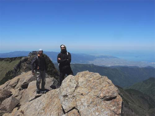 The top Ishizuchi-san, Shikoku's highest mountain |
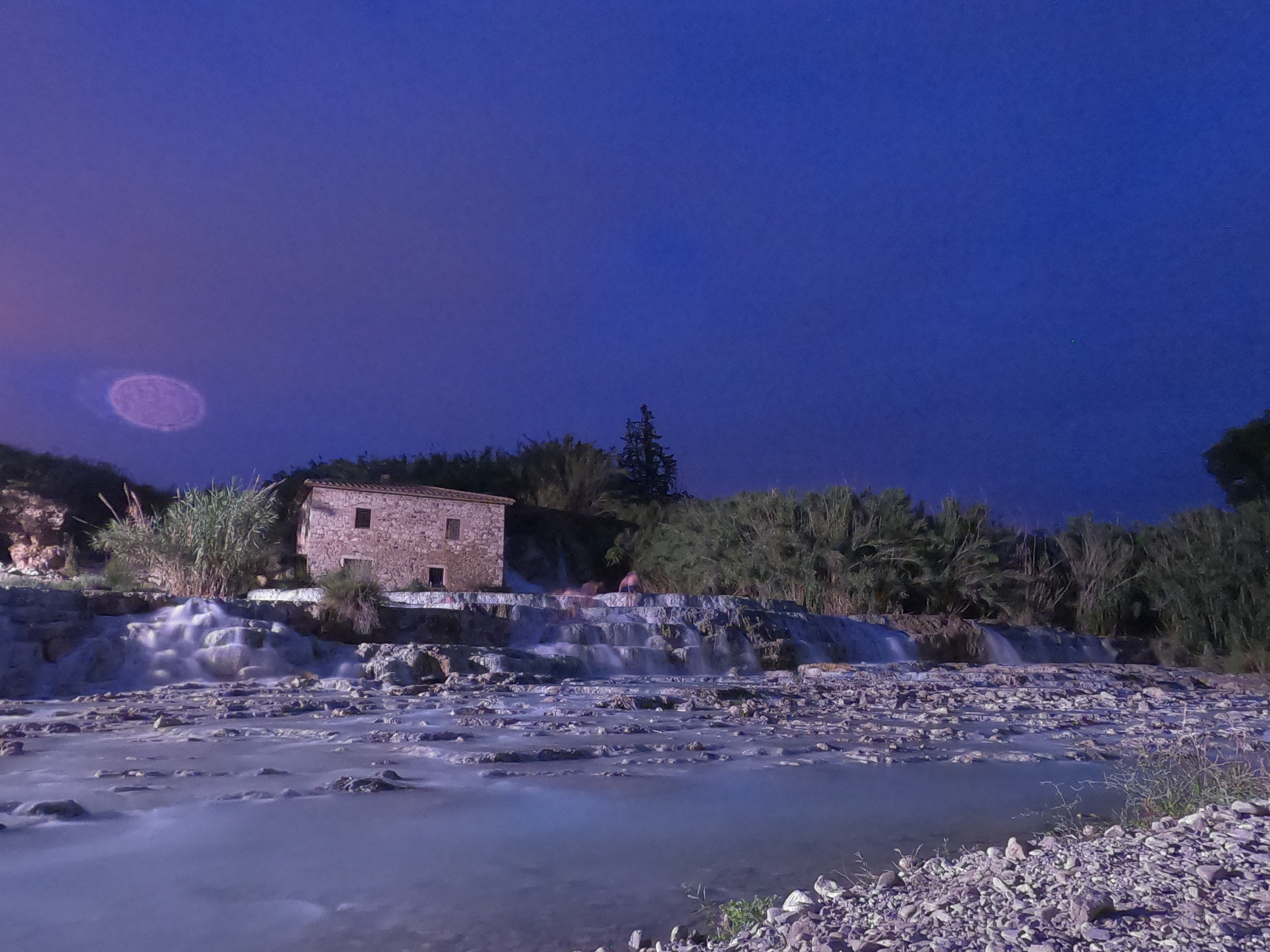
VettaMare (87 mi)
This trail passes through the central portion of Maremma, a little-known part of Tuscany, but is well worth a visit. The path starts from the top of Monte Amiata and arrives in Porto Ercole. It consists of seven stages and touches several tows, five of which are listed among the most beautiful in Italy. You can visit places rich in art and history, surrounded by luxuriant vegetation that gradually changes during the descending from the mountain to the sea.
Click here to download the GPX track
![]()
Click here to download the KML track
![]()
Explore the trail on Google Maps!
![]()
Click here to download the GPX track
![]()
Click here to download the KML track
![]()
Explore the trail on Google Maps!
![]()
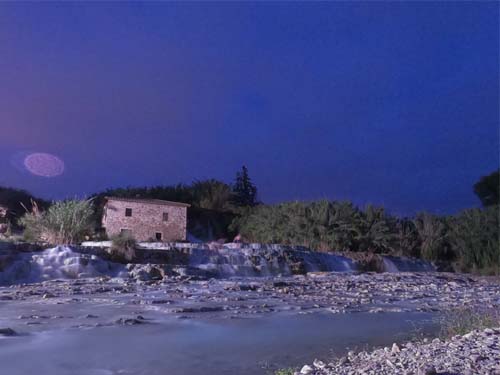 Cascate del Mulino thermal spring, in Saturnia |
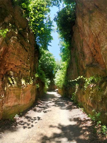 Etruscan Via Cava, in Sovana |
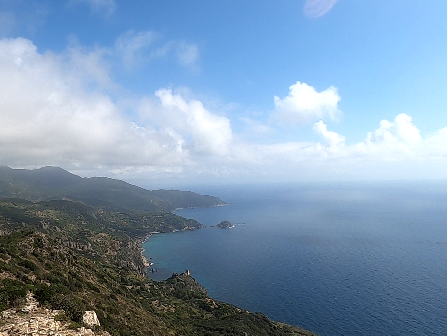
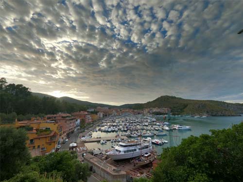 View of Porto Ercole |
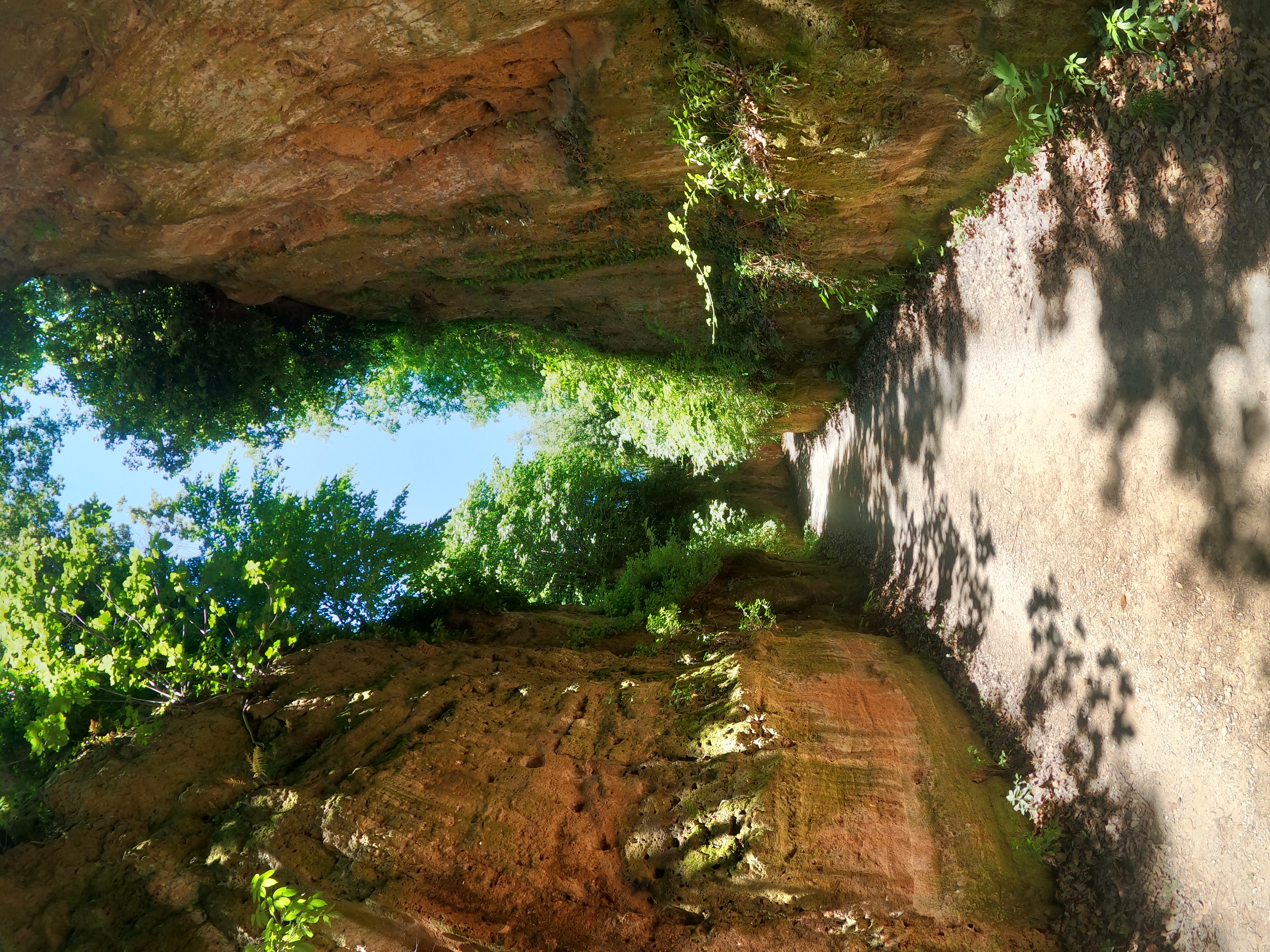
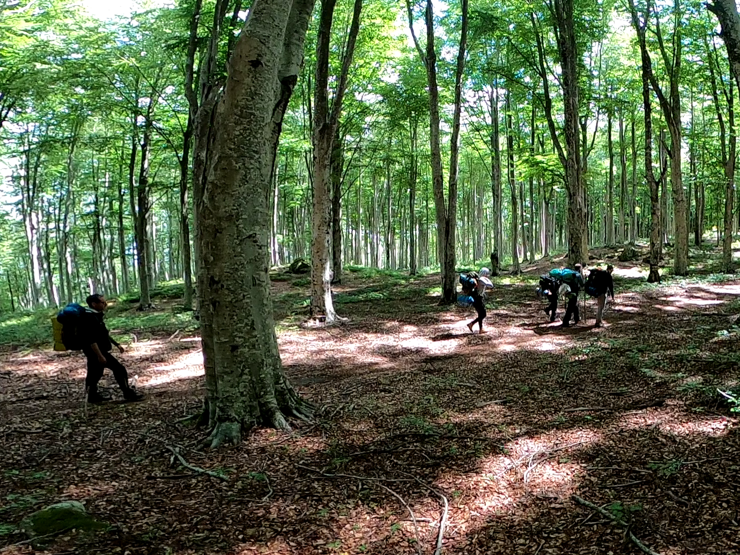
Monte Amiata Ring Path (18 mi)
This round path revolves around the ancient volcanic cone of Monte Amiata, a solitary mountain situated in Southern Tuscany, between the provinces of Siena and Grosseto. The trail passes through the largest beech wood of Europe and when you walk inside it, you have the impression to have entered a fairy tale, where the many legends that surround this land seem to come to life.
Click here to download the GPX track
![]()
Click here to download the KML track
![]()
Explore the trail on Google Maps!
![]()
Click here to download the GPX track
![]()
Click here to download the KML track
![]()
Explore the trail on Google Maps!
![]()
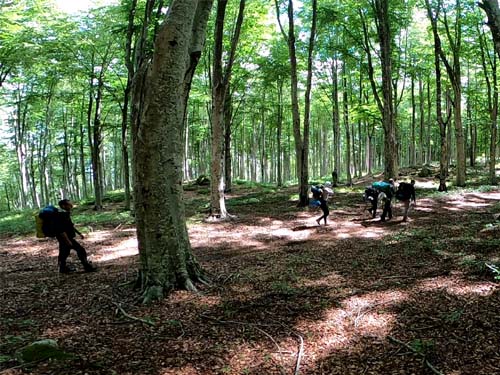 The trail in the forest |
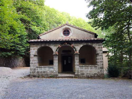 Santa Maria dell'Ermeta church |
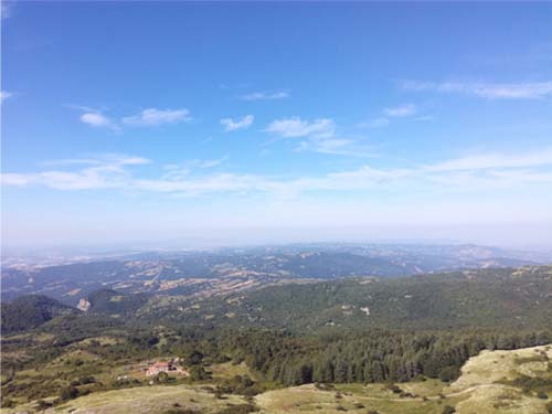
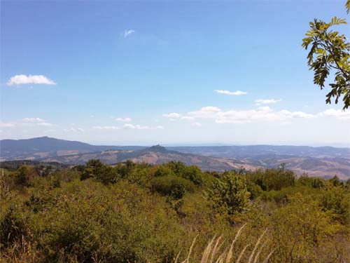 Panoramic view from the trail |
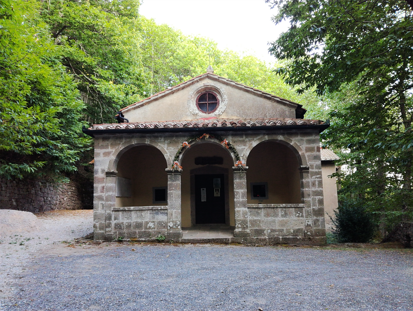
Monte Labbro Ring Path (15.5 km)
This round path starts from Arcidosso, a town situated at the foot of Monte Amiata. The trail, surrounded by nature, passes near the local wildlife park, touches Merigar, a Buddhist community established in 1981, and leads to the ruins on the top of Monte Labbro. Here, in the seventies of the 18th century, Davide Lazzaretti established the Jurisdavid Church, and this place is totally worth a visit for its suggestive atmosphere and for the amazing view you can enjoy from the top of the tower.
Click here to download the GPX track
![]()
Click here to download the KML track
![]()
Explore the trail on Google Maps!
![]()
Click here to download the GPX track
![]()
Click here to download the KML track
![]()
Explore the trail on Google Maps!
![]()
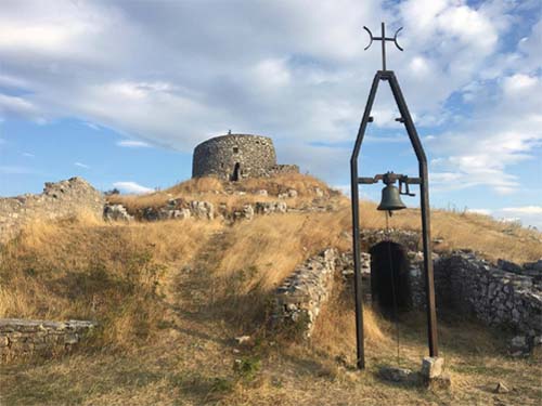 The Jurisdavid Tower, on the top of Monte Labbro |
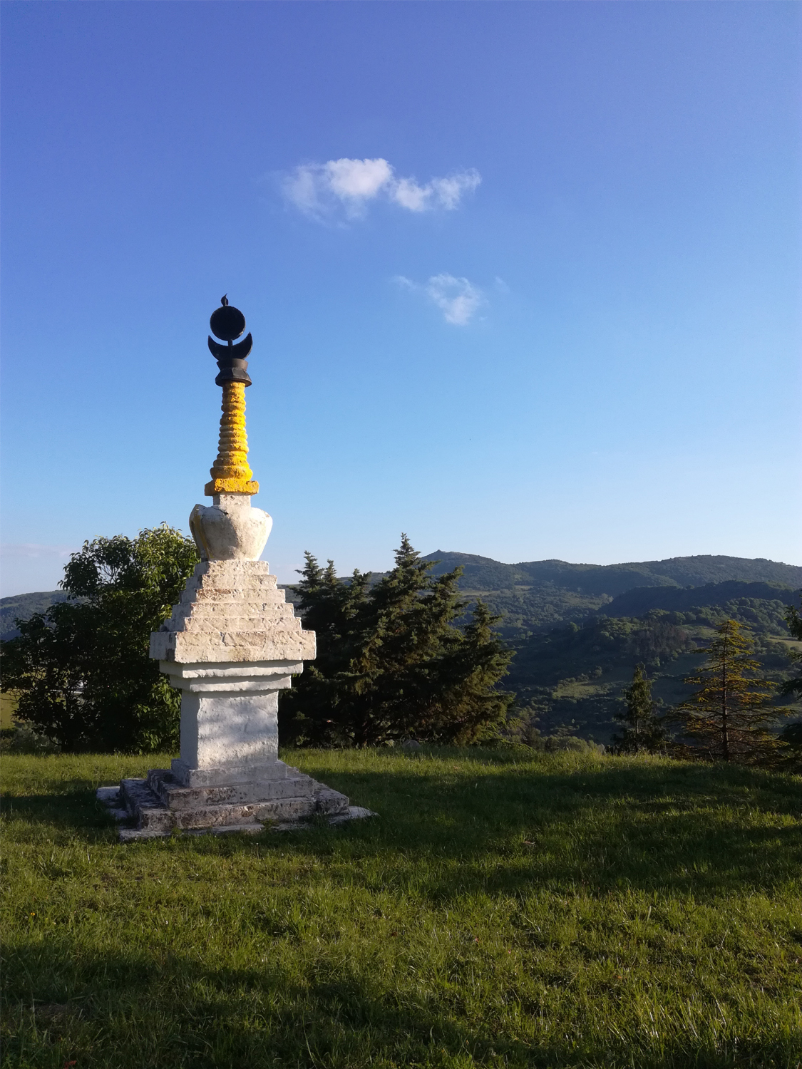
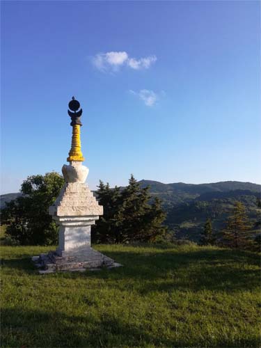 A stupa in Merigar |
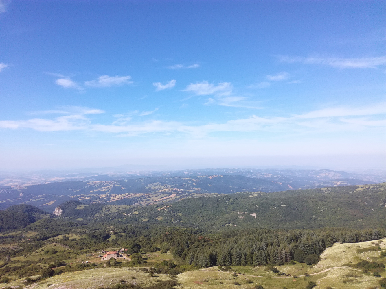
 Panoramic view from the top of the Jurisdavid Tower |
Monte Argentario Tour (18 mi)
Monte Argentario, situated in the southern part of Tuscany, near the border with Lazio, is rich in historical and natural beauties. You can enjoy some of them by walking this trail that starts in Porto Santo Stefano and arrives in Porto Ercole, travelling across the hidden hinterland of Monte Argentario. Between a visit to one of the ancient guard towers and a picture of the breathtaking view, you cannot miss a dive in the crystal clear water of the Tyrrhenian Sea, Monte Argentario is full of rocky coves, just pick one and relax on the beach!
Click here to download the GPX track
![]()
Click here to download the KML track
![]()
Explore the trail on Google Maps!
![]()
Click here to download the GPX track
![]()
Click here to download the KML track
![]()
Explore the trail on Google Maps!
![]()
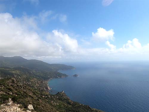 Panoramic view from Capo d'Uomo Tower |
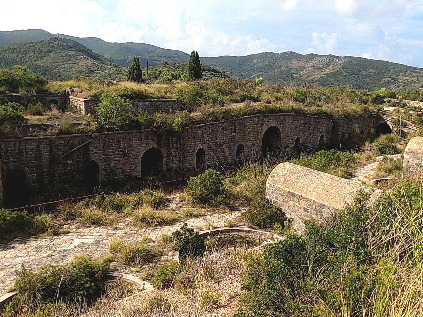
 Pozzarello Fortress |
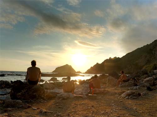 Sunset at Mar Morto Cove |